


The West Ashley Greenway

I recently learned of SCtrails.net which lists all the Biking and Hiking Trails in the State of South Carolina.
On this website, I discovered the West Ashley Greenway, which runs from the Windermere district, just over the Stono River from James Island, to Main Road on Johns Island. I had heard of this trail, but I did not realize it was so long. (10.5 miles.)
On Sunday I decided to check it out and picked up the trail at about the half way point about a mile from my home. I headed west towards Main Road; there was no one else on the trail at 7:00 am. The first part of the trail was hard packed dirt and grass, easy riding on my road bike; I stopped to take a few pictures.


As I neared Main Road the trail went over some marshes; the last mile was loose stones and a little tough, but still ridable. (See below.) The trail emerged under the railroad bridge on Main Road, just before the Stono River Bridge. There is easy access onto the Stono Bridge without having to cross Main Road, and even on the way back, you make a left at the foot of the bridge, and keep going left under the bridge (See below.) to the access road on the opposite side that takes you back to the trail head.
 The trail was once an old railroad line and runs parallel with Savannah Highway (Route 17.) Savannah Highway is the main road South out of Charleston and has very heavy traffic. I will only ride it on the weekends when the traffic is a little lighter.
The trail enables me to bypass Rte.17 altogether. Main Road is also a busy two-lane highway that leads to Kiawah Island and Seabrook. Not good for riding, however, the Stono River Bridge has a wide shoulder, and once over the bridge it is only a short distance to a light where a right turn takes you onto Chisolm Road.
Chisholm is a road that goes nowhere; it just does a ten-mile loop and then joins back up with Main Road. As a result the only traffic on this road are local residents, and they are so used to seeing cyclists that they always give plenty of room when passing.
The road has a nice surface and much of it is shaded by trees on both sides, giving respite from the summer heat. (See picture below.)

On the weekend it is not unusual to see as many cyclists on this road as cars. Many local cyclists drive out there, then park and ride their bikes. I hate to do that on principal, plus we are a one-car family, so tying up the vehicle while I ride my bike would be a little selfish.
I am excited about the Greenway Trail because for me it makes riding Chisolm a possibility during the week and not just weekends. I actually enjoyed riding it, took me back to my old cyclo-cross days.
The European pros know from experience of riding on cobblestones, the faster you ride over rough ground the more comfortable it is. I rode this trail using the highest gear I could handle. A high gear gives more traction, and when you are pushing hard your weight is on the pedals rather than the saddle. Arms bent and holding the bars loosely allows the bike to float over the rough ground.
The only time I will not be able to ride this trail is when the ground is wet; I will also have to clean my bike a little more often. This is a chore I could do without; I would rather ride my bike than clean it. Oh well.
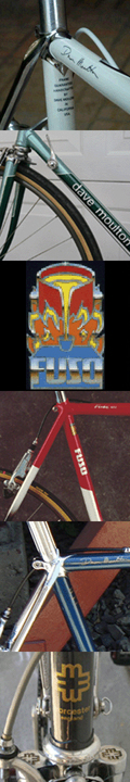
 Dave Moulton
Reader Comments (9)
I'll be back in Savannah for a few days at the end of the month and will try to squeeze in some short rides. They have some similar routes there.
And after the Georgia/South Carolina heat, New York seems downright chilly.
West Ashley covers a large area, and strictly speaking, Windermere is just over the Stono River from James Island. I think by saying James Island it gives people a better idea of where the trail starts. However, in the interest of being as correct as possible, I have edited the post.
I'll be in your neck of the woods on Saturday. Doing a charity ride from Seneca, SC to Mt. Pleasant - 300 miles in three days.
I'd love to meet you in person if you have the time. Thanks for keeping me entertained with your insightful blogs.
Josh Boggs
-www.probikewrench.blogspot.com
Dave, the Stono Bridge is the other bridge onto Johns Island, on Maybank Highway. The one on Main Road is the Limehouse Bridge, and I think (not 100% sure but almost) it goes over the Intracoastal Waterway.
I really enjoyed your post. Got to it roundabout, from TheDigitel.com, which linked to Charleston InsideOut, which linked to you (just FYI in case you're curious). Makes me wish my bike and my legs were up to par. :-)
The information was wonderfully explicit, and the pictures were fabulous! Can't wait to try it. And thanks so much for the link.